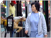
Tottenville, Staten Island, New York City
|
Getting Started
Index
NYC Neighborhoods
Manhattan
Brooklyn
Queens
Bronx
Staten Island
NYC Icons
Chrysler Building
Flatiron Building
Empire State Building
Safe NYC
NYPD
FDNY
NYC Weather
NYC Climate
NYC Weather Forecast
Winter Season
Spring Season
Summer Season
Fall Season
NYC History & Politics
New York City History
Tammany Hall and Politics
New York City Politicians
New York City Personalities
Culture of Gotham City
Culture of the city
Cultural diversity
City in popular culture
|
Tottenville, area approx. 1.7 square miles (4.4 km²), is the southernmost neighborhood of Staten Island, New York City and New York State. Originally named Bentley Manor by one of its first settlers, Captain Christopher Billop (1638-1726), after the ship on which he sailed to America in 1667, the district was renamed Tottenville in 1869, apparently in honor of Gilbert Totten, a local American Revolutionary War hero.
History
The Unami Indians, a branch of the Lenape or Delaware nation, were the original inhabitants of all Staten Island, including Tottenville; some of their artifacts and evidence of burial sites have been discovered near Ward's Point, which is New York City and New York State's southernmost point.
During the colonial period and for a significant time thereafter, Tottenville was an important way-station for travelers between New York City (of which Staten Island did not formally become a part until 1898) and Philadelphia, as it was the site of a ferry that crossed the Arthur Kill to Perth Amboy, New Jersey. This ferry became less important when the Outerbridge Crossing opened in 1928, but continued to operate until 1963.
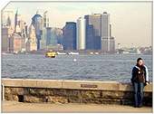
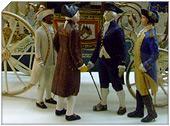
Two distinctive landmarks, the Bethel United Methodist Church (erected in 1840 and rebuilt on the same site in 1886 after a fire had destroyed the original structure), and an abandoned factory originally built in 1900 for use as a smelting plant and later operated for recycling by Lucent Technologies (which closed the facility in 2001), stand at the northern approaches to the neighborhood. Tottenville is bounded on the west and south by the Arthur Kill and on the east by Raritan Bay (the mouth of the Raritan River lies immediately to the south of where the Arthur Kill empties into the bay, which is also sometimes reckoned as being part of the Atlantic Ocean). At the opposite end is the Conference House, built by Christopher Billop and so named because it was the site of abortive negotiations in 1776 to end the Revolutionary War (it is now the centerpiece of the city park known by the same name). The Billop family, who built the estate in 1678, continued to own it and the surrounding property at the time the 1776 meeting took place, but in 1784 their land was confiscated because the family had been Tories during the war.
Many small factories once dotted the neighborhood's western shoreline, but most of these are no longer in operation. Boat construction also once flourished along this shoreline, but this industry was rendered obsolete when the practice of using steel rather than wood to build boats became dominant in the years immediately after 1900. World War I spawned a revival of shipbuilding activity, but it proved only temporary, and Tottenville's last shipyard closed in 1930. Another activity formerly prominent in Tottenville was the harvesting of oysters from the surrounding waters, which ceased in 1916 when the New York City Health Department determined that pollution had made it unsafe. As of 2005, oyster harvesting has since been reopened.
During the 1990s, the section of Tottenville southeast of Hylan Boulevard, until then nearly uninhabited, saw massive new home construction, but the district's population density still ranks among the lowest in New York City, as does the crime rate. Business establishments were largely restricted to the Main Street corridor in the heart of the neighborhood until the early 2000s, when a second commercial core began to emerge at the north end of the community, along Page Avenue west of Amboy Road; further expansion of the latter area is due in 2005 as the former Lucent Technologies property is being developed for this purpose. Starting in October 2006, the western part of the site is being cleaned up, and is scheduled to be finished within a year. This factory was purchased by Western Electric in the middle 20th century and used principally to recycle copper and other metals from old wires until it was closed late in the century by Lucent. The site suffered chemical contamination. Mill Creek, which runs through the site, will also be cleaned as part of the project.
|
New York City Search
Quick NYC
|
|
|
 How safe is New York City?
 Contrary to popular belief, the City consistantly ranks in the top ten safest large cities in the United States. The NYPD is the largest municipal police force in the world and has it's own Movie/TV Unit. |

New York has a humid continental climate resulting from prevailing wind patterns that bring cool air from the interior of the North American continent. New York winters are typically cold with moderate snowfall.  New York Weather Forecast New York Weather Forecast |

New York's two key demographic features are its density and diversity. The New York City metropolitan area is home to the largest Jewish community outside Israel. It is also home to nearly a quarter of the nation's South Asians, and the largest African American community of any city in the country. Ethnic composition |

New York Newspapers
 
|