Raritan Bay : NYC Tourist Guide
Raritan Bay in NYC, New York, USAHome » Raritan Bay » Info
Raritan Bay
|
Getting Started
Index
NYC Neighborhoods
Manhattan
Brooklyn
Queens
Bronx
Staten Island
NYC Icons
Chrysler Building
Flatiron Building
Empire State Building
Safe NYC
NYPD
FDNY
NYC Weather
NYC Climate
NYC Weather Forecast
Winter Season
Spring Season
Summer Season
Fall Season
NYC History & Politics
New York City History
Tammany Hall and Politics
New York City Politicians
New York City Personalities
Culture of Gotham City
Culture of the city
Cultural diversity
City in popular culture
|
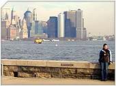
Raritan Bay is a bay between the U.S. states of New York and New Jersey. It is located at the confluence of the Arthur Kill and the Raritan River, which flows into the bay from the west. The bay is bounded on the north by Perth Amboy, New Jersey, and Staten Island in New York, on the south by Monmouth County, and on the east by the Naval Weapons Station Earle pier.
The bay and river are named after the Raritans, a tribe of the Lenape, who lived in the immediate area around the bay during the 17th century at the time of the arrival of the Dutch colonists.
Throughout the history, the bay has been a prime fishing ground, especially for commercial oyster fishing, until the 20th century. The bay is crossed by a dredged channel allowing commercial ships to enter the Arthur Kill.
Geologic history
The Arthur Kill is an abandoned river channel carved by an ancestral phase of the Hudson River resulting from the blockage of the main channel of the Hudson at the Verrazano Narrows by moraine or ice. The size of the Arthur Kill channel is large, suggesting that it was, for a time, the primary drainage from the region. However, it was not a primary drainage for long because the river did not have enough time to carve a broad flood plain. This channel probably developed during Stage 3 (a mid-Wisconsin interglacial stage). By comparison, the valley of the Raritan River to the south is much broader. This is an indication that the Raritan was perhaps the major drainage channel along the ice front throughout the Wisconsin glaciation (Stages 1, 2, 3 and 4). Prior to that time the region drained southward across the saddle between the Atlantic Highlands and the Newark Basin into the Delaware River Valley. This saddle area is a very broad flood plain that preserves river terrace gravels (Pensauken Formation) from the Sangemon Interglacial State (Stage 5), as well as older Pleistocene fluvial deposits (The Bridgetown Formation). During the lowstand in sea level caused by the Wisconsin glacier, the Raritan River carved back into its headlands and captured the major drainages from the Newark Basin.
|
New York City Search
Quick NYC
|
|
|
 How safe is New York City?
 Contrary to popular belief, the City consistantly ranks in the top ten safest large cities in the United States. The NYPD is the largest municipal police force in the world and has it's own Movie/TV Unit. |
New York has a humid continental climate resulting from prevailing wind patterns that bring cool air from the interior of the North American continent. New York winters are typically cold with moderate snowfall.  New York Weather Forecast New York Weather Forecast |

New York's two key demographic features are its density and diversity. The New York City metropolitan area is home to the largest Jewish community outside Israel. It is also home to nearly a quarter of the nation's South Asians, and the largest African American community of any city in the country. Ethnic composition |

New York Newspapers
 
|