Newark Bay : NYC Tourist Guide

Newark Bay in NYC, New York, USA


Home » Newark Bay » Info

Newark Bay

Getting Started

Index

NYC Neighborhoods

Manhattan
Brooklyn
Queens
Bronx
Staten Island

NYC Icons

Chrysler Building
Flatiron Building
Empire State Building

Safe NYC

NYPD
FDNY

NYC Weather

NYC Climate
NYC Weather Forecast
Winter Season
Spring Season
Summer Season
Fall Season

NYC History & Politics

New York City History
Tammany Hall and Politics
New York City Politicians
New York City Personalities

Culture of Gotham City

Culture of the city
Cultural diversity
City in popular culture

Newark Bay
Newark Bay is a body of water, a tidal back bay of New York Harbor formed at the confluence of the Passaic and Hackensack Rivers. On its south end, it is connected to Upper New York Bay by the Kill Van Kull, as well as to Raritan Bay by the Arthur Kill. It contains the Port Newark-Elizabeth Marine Terminal.
It is enclosed on the west by the New Jersey cities of Newark and Elizabeth, and on the east by Jersey City and Bayonne. It is enclosed on the south by Staten Island.
It contains Shooters Island, which is part of the borough of Staten Island.
The western edge of Newark Bay was originally shallow tidal wetlands covering approximately 12 square miles. In 1914 the City of Newark began excavating an angled shipping channel in the northeastern quadrant of the wetland which formed the basis of Port Newark. Work on the channel and terminal facilities on its north side accellerated during World War I, when the federal government took control of Port Newark. Shipping operations languished during the interwar years, and in 1927, the City of Newark started construction of Newark Airport on the northwest quadrant of the wetlands which lay between Port Newark and the edge of the developed city. A north-south causeway containing the tracks of the Jersey Central Railroad and the Lincoln Highway (now the N.J. Turnpike)separated the airport from the seaport.
The Port of New York Authority (now the Port Authority of New York and New Jersey) took over the operations of Port Newark and the Newark Airport in 1948 and began modernizing and expanding both facilities southward. In 1958, the Port Authority dredged another shipping channel which straightened the course of Bound Brook, the tidal inlet forming the boundary between Newark and Elizabeth. Dredged materials was used to create new upland south of the new Elizabeth Channel, where the Port Authority constructed the Elizabeth Marine Terminal. The first shipping facility to open upon the Elizabeth Channel was the new 90-acre Sea-Land Container Terminal, which was the prototype for virtually every other container terminal constructed thereafter.
Although a shallow tidal estuary, it is periodically dredged to accommodate ocean-going container ship access to Port Newark-Elizabeth Marine Terminal along its western side.
It is spanned by the Vincent R. Casciano Memorial Bridge connecting Bayonne and Newark.


This is NYC

New York City Neighborhoods

NYC has a rich history in diversity and the city as a whole is nothing more than many small neighborhoods. Explore it with us..

NYC Neighborhoods
Manhattan Island

NYC Waterfronts & Beaches

NYC's waterfront is roughly 600 miles long and the overall form of the Harbor has remained unchanged from the time of Giovanni da Verrazzano. Learn more about the harbor, its shores and its waterways.

NYC Waterfronts
New York City Beaches

History and Politics of NYC

Did you know that New York City was briefly the U.S. capital during 1789-90 and was state capital until 1797?

New York City History
Tammany Hall and Politics
New York City Politicians

Culture of Gotham City

The culture of NYC is shaped by centuries of immigration, the city's size and variety, and its status as the cultural capital of the United States.

Culture of the city
Cultural diversity
City in popular culture


Travel & Transportation

The dominant mode of transportation in New York City is mass transit - Subways and Buses. However, it is the Taxicabs that are real New York icons!

Safety & Security

How safe is New York City? Contrary to popular belief, the City consistantly ranks in the top ten safest large cities in the United States. The NYPD is the largest municipal police force in the world and has it's own Movie/TV Unit.

New York Climate

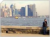
New York has a humid continental climate resulting from prevailing wind patterns that bring cool air from the interior of the North American continent. New York winters are typically cold with moderate snowfall.
New York Weather Forecast

Demographics

New York's two key demographic features are its density and diversity. The New York City metropolitan area is home to the largest Jewish community outside Israel. It is also home to nearly a quarter of the nation's South Asians, and the largest African American community of any city in the country.
Ethnic composition


New York Newspapers

Niagara Falls Express: Overnight Tour from New York Romance Over Manhattan Private Helicopter Flight

home | get listed | privacy policy | site map back to top

Quick Links to Neighborhoods » Manhattan | Bronx | Brooklyn | Queens | Staten Island

Website: © 2004-08 NYCTouristGuide.com All Rights Reserved. Permission must be secured prior to duplication of any content, including images.
All Photos: © 2000-2007 Nishanth Gopinathan | StockPhotographs.org, unless otherwise credited. All International Rights Reserved.

Hosting: PixvieweRTM Web Hosting | Web Design: Live EyesTM (LiveEyes.org)