Getting Started
Index
NYC Neighborhoods
Manhattan
Brooklyn
Queens
Bronx
Staten Island
NYC Icons
Chrysler Building
Flatiron Building
Empire State Building
Safe NYC
NYPD
FDNY
NYC Weather
NYC Climate
NYC Weather Forecast
Winter Season
Spring Season
Summer Season
Fall Season
NYC History & Politics
New York City History
Tammany Hall and Politics
New York City Politicians
New York City Personalities
Culture of Gotham City
Culture of the city
Cultural diversity
City in popular culture
|
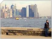
New York Harbor, a geographic term, refers collectively to the rivers, bays, and tidal estuaries near the mouth of the Hudson River in the vicinity of New York City. This is sometimes construed in the sense "the Ports of New York and New Jersey". More narrowly, the term occasionally refers only to "Upper New York Bay".
In the broad sense, the term includes the following bodies of water and their waterfronts: Upper New York Bay, Lower New York Bay, North River (i.e. the lowest part of the Hudson River), East River, Kill Van Kull, Newark Bay, Arthur Kill, The Narrows, Jamaica Bay, Raritan Bay, and Harlem River. This includes about 1200 square miles, with over a 1000 miles of shoreline. At peak it contained 650 miles of developed waterfront in 11 individual, active ports in Manhattan, Brooklyn, Queens, the Bronx, Staten Island, Perth Amboy, Elizabeth, Bayonne, Newark, Jersey City, Hoboken, and Weehawken. Although the U.S. Board of Geographic Names does not include the term, New York Harbor has important historical, governmental, commercial, and ecological usages.
Harbor History
Before the Erie Canal
The aboriginal population of the seventeenth century New York Harbor, the Lenape were linguistically tied to the Algonquians, and used the waterways for fishing and travel. They greeted the first recorded European in the Harbor, Giovanni da Verrazzano in 1524. In 1624 the first permanent European settlement was started in Manhattan, and eight years later in Brooklyn; soon these were connected by ferry operation. The colonial Dutch Governor Peter Stuyvesant ordered construction of the first wharf on the Manhattan bank of the lower East River sheltered from winds and ice, which was completed late in 1648 and called Schreyers Hook Dock (near what is now Pearl and Broad Streets). This prepared New York as a leading port for the British colonies and then within the newly independent United States. In 1686 the British colonial officials gave the municipality control over the waterfront.
The Erie Canal and its consequences
In 1824 the first American drydock was completed on the East River. Because of its location and depth, the Port grew rapidly with the introduction of steamships; and then with the completion in 1825 of the Erie Canal New York became the most important transhipping port between the American interior and Europe as well as coastwise destinations. By about 1840, more passengers and a greater tonnage of cargo came through the port of New York than all other major harbors in the country combined and by 1900 it was one of the great international ports. The main immigrant port of entry at Ellis Island had 12 million arrivals from 1892 to 1954.
In 1870 the city established the Department of Docks to systematize waterfront development, with George B. McClellan as the first engineer in chief.
Before the major road improvements allowed efficient trucking, rail freight was ferried to Manhattan from New Jersey, meaning railroads had small fleets of towboats, barges, and 323 car floats, specially designed barges with rails so cars could be rolled on. New York subsidized this service which undercut rival ports.
World War II and later
After the United States entered World War II operation Drumbeat loosed the top U-Boat aces against the merchant fleet in U.S. territorial waters in January 1942, starting the Second happy time. The U-Boat captains were able to silhouette target ships against the glow of city lights, and attacked with relative impunity, in spite of U.S. Naval concentrations within the Harbor. Casualties included the tankers Coimbria off Sandy Hook and Norness off Long Island. New York Harbor, as the major convoy embarkation point for the U.S., was effectively a staging area in the Second Battle of the Atlantic, with the U.S. Merchant Marine losses of 1 of 26 was similar to those of the other U.S. forces.
The Harbor reached its peak activity in March 1943, during World War II, with 543 ships at anchor, awaiting assignment to convoy or berthing (with as many as 425 seagoing vessel already at one of the 750 piers or docks). 1100 warehouses with nearly 1.5 square miles of enclosed space served freight along with 575 tugboats and 39 active shipyards (perhaps most importantly New York Naval Shipyard founded 1801). With a staggering inventory of heavy equipment, this made New York Harbor the busiest in the world.
|
New York City Search
Quick NYC
|


 New York Weather Forecast